The Lemosho Route is often called the most beautiful of the Kilimanjaro routes. This relatively new trail on Kilimanjaro is one of my favourite ways to reach Uhruru Peak.
It starts on the Western side of Mount Kilimanjaro at the Londorossi Gate.
This trek was introduced as an alternative to the Shira Route which begins at a higher, more challenging altitude. Lemosho has a better, gentler acclimatisation profile and a high summit success rate.
In this article, I explain why the Lemosho Route is a good choice for your Kilimanjaro trek.
I'll also go into detail about the itinerary and explain the difference between the 7 and 8 day options. Read on for everything you need to know about this popular route!
My Quick Takeaways:
The Lemosho Route is renowned for its stunning scenery and high summit success rates. Here's a quick overview to get you excited about conquering this Kilimanjaro route:
Starting Point:
- Begins at Londorossi Gate on Kilimanjaro's western side.
Route Highlights:
- Traverses the Shira Plateau, offering expansive vistas.
- Joins the Machame Route near Lava Tower, providing diverse landscapes.
- Features a favourable acclimatisation profile, enhancing summit success rates.
Duration:
- Typically completed over 7 to 8 days, allowing for adequate acclimatisation.
Accommodation:
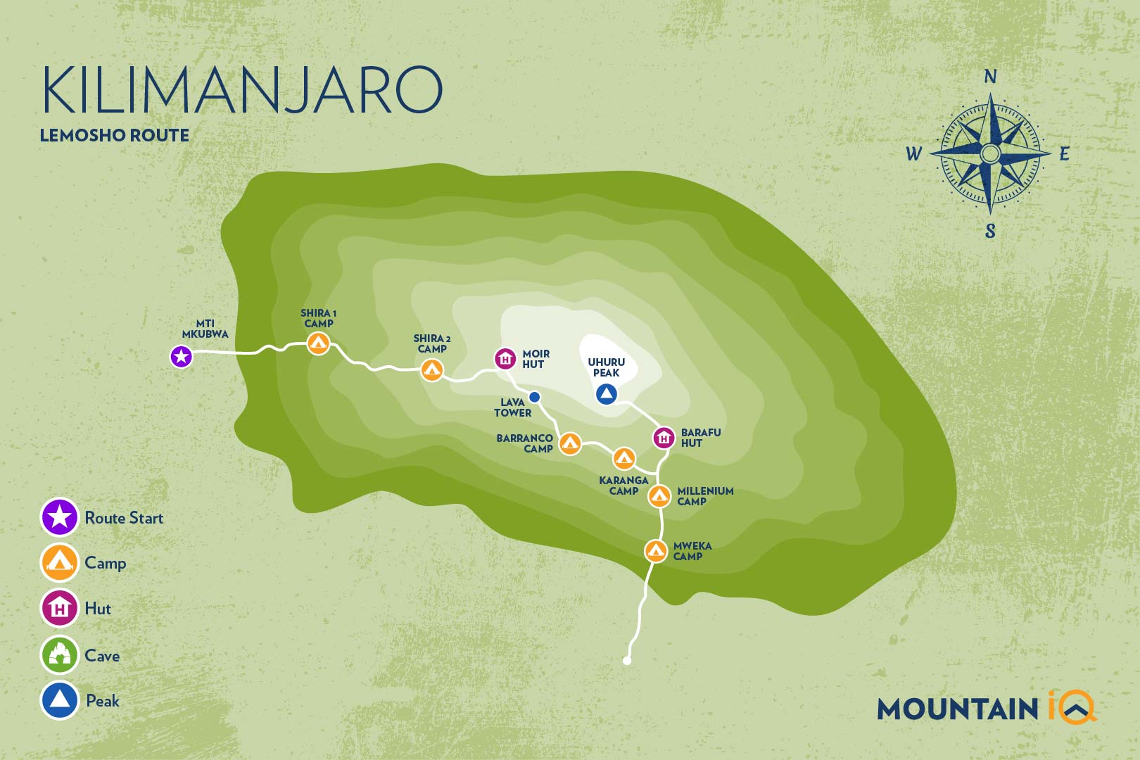
- Campsites along the route include Mti Mkubwa, Shira Camps 1 and 2, Barranco, Karanga, and Barafu.
Difficulty:
- Considered moderately challenging due to its length and altitude.
The Lemosho Route is ideal for trekkers seeking a less crowded path with rich biodiversity and varied terrains. Ready to learn more about this stunning Kilimanjaro route? Let's rock.
Plan your Kilimanjaro trek
Get a quote from my recommended local Kilimanjaro operator
Why Choose The Kilimanjaro Lemosho Route?
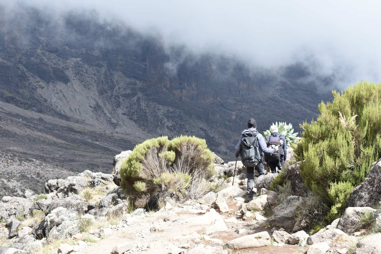
The trek through the canyon from Lava Tower to Barranco Camp is one of the most scenic parts of the route.
High Summit Success Rate
Arguably the top reason for climbing Kilimanjaro Lemosho Route is that it has one of the highest summit success rates.
This is because Lemosho has a long and gentle ascent which gives your body a better chance to adjust to the low oxygen levels. It's one of the best acclimatisation profiles on Kilimanjaro.
According to our local operators, the 8-Day Lemosho route generally has a 90% summit success rate while the 7-Day option is slightly lower (around 80%).
I'll discuss the difference between these options later in the article.

Plan your Kilimanjaro trek
Get a quote from my recommended local Kilimanjaro operator
Stunning Scenery
A major reason to hike Kilimanjaro Lemosho Route is for the beautiful landscapes. You start the trek in the rainforest and make your way up to the Shira Plateau.
The western side of Kilimanjaro is still very wild and you may get lucky and spot large antelope, buffalo and maybe even elephant.
The Lemosho Route joins the Machame Route at Lava Tower. Hikers on Lemosho route cross the entire Shira Plateau (west to east) which is a pleasant and much flatter hike compared to the steep Machame Route.
You will also generally find less people on the Lemosho route up until the trails meet.
The trail then heads down towards Barranco Valley via the Southern Circuit (see map below).
As with the Machame Route, Lemosho trekkers need to transverse the Barranco Wall and then summit from Barafu Camp.
Descent is via the Mweka route. This is a scenic way to end the journey you descend through Moorland and back down to jungle.

Plan your Kilimanjaro trek
Get a quote from my recommended local Kilimanjaro operator
Lemosho Route Map
Most trekkers complete the Lemosho Route in 8 days; however some tour operators offer 7 day treks and 6 day hikes (not recommended) on the Lemosho.
The 8-day variation is great for acclimatisation and of course increases the probability of success (see Kilimanjaro success rates).
The 7-day route typically skips either Shira 1or Karanga camp. The 8-Day option has that extra acclimatization day, more on this later on.
Lemosho Route Itinerary
Below is the typical itinerary for an 8-day Lemosho Route.
Day 1 – Londorossi Gate (2,100 meters) – start point 2,360 meters to Mti Mkubwa Camp (2,820 meters)
Distance: ~5.5km / 3.5 miles
Trekking time: 3-4 hours
Zone: Rainforest
The Lemosho Route departs from the far West side of Mount Kilimanjaro. Getting to Londorossi Gate (2,100 meters) takes approximately 2 hours from Moshi and longer from Arusha.
At the gate you will register with the Kilimanjaro National Park authorities before getting back into vehicles to be transported to the starting point which is a further 12km from Londorossi.
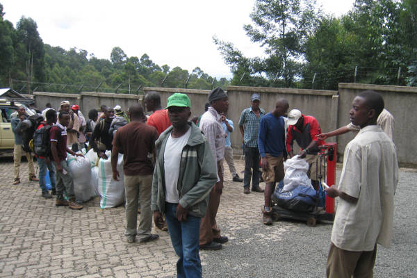
Porters weighing gear
During the wet season (April-May) the track can be very inaccessible to vehicles and you may need to walk the last few miles to the starting point.
Most tour operators provide lunch at this point before starting the short trek to Mti Mkubwa Camp (2,820 meters).
Spotting large wildlife like elephant and buffalo is unlikely, but is not unheard of on this stretch of the mountain (see what animals live on Mount Kilimanjaro).
Dinner will be served when you reach Mti Mkubwa Camp ('also known as Big Tree Camp'.

Plan your Kilimanjaro trek
Get a quote from my recommended local Kilimanjaro operator
Day 2 – Mti Mkubwa Camp (2,820 meters) to Shira Camp 1 (3,500 meters)
Distance: ~8km / 5 miles
Trekking time: 5-6 hours
Zone: Low-alpine zone
Day two starts with a gradual hike through the final stretch of the rainforest zone and then gets steeper as you approach the low alpine moorland zone.
The trek is relatively short and easy to Shira Camp 1, which is on the western edge of the Shira Plateau; just over 8km from your starting point.
Day 3 – Shira Camp 1 (3,500 meters) to Moir Hut (4,200m)
Distance: 14km / 8.5 miles
Trekking time: 5-7 hours
Zone: Low-alpine zone / High-alpine zone
From Shira Camp 1 you will continue on your hike across and up the Shira plateau to Shira Camp 2 at 3,850 meters.
Here you will join trekkers from the Machame Route whilst enjoying stunning views across the valley below and Western Breach of Kilimanjaro above.
The plateau is exposed so be prepared for strong winds with temperatures getting below zero in the early hours.
You then continue up the Shira Caldera and onto an off-the-beaten path to Moir Hut.
Today is long and finishes at high altitude. You may start feeling altitude sickness symptoms. Make sure you monitor yourself closely. Sleeping high on this night will pay dividends on your trek going forward.

Plan your Kilimanjaro trek
Get a quote from my recommended local Kilimanjaro operator
Day 4 – Moir Hut (4,200 meters) to Lava Tower (4,600 meters) and then Barranco Camp (3,900 meters)
Distance: 12 km / 7.5 miles
Trekking time: 6-7 hours
Zone: High-alpine zone
On day four you will continue trekking through a desert-like landscape as you approach Lava Tower and the Shark’s Tooth formation at 4,600 meters.
You will have lunch at Lava Tower before joining the Southern Circuit trail (see map above) which descends to Barranco Camp 3,900 meters where you will spend the night at a very similar elevation as the night before.
Climbing high and sleeping low is a good way to acclimatise the body to altitude.
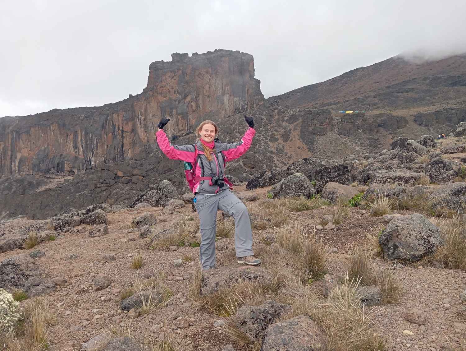
Lava Tower is an iconic formation where the Lemosho and Machame routes meet up. Most groups stop to have lunch at this high altitude before descending to Barranco Camp.
Day 5 – Barranco Camp (3,900 meters) to Karanga Camp (3,960m)
Distance: 7 km / 4 miles
Trekking time: 4 hours
Zone: High-alpine zone
On day five you will be presented with the relatively steep Barranco ‘Breakfast’ climb, a 257 meter scramble up the Barranco Wall. Be prepared to use all four limbs as you traverse the wall to the top of the Karanga Valley.
From here you will follow a path that sojourns through many inclines and declines to Karanga Camp (3,960 meters). For those on an eight day hike, this will be your camp for the night.
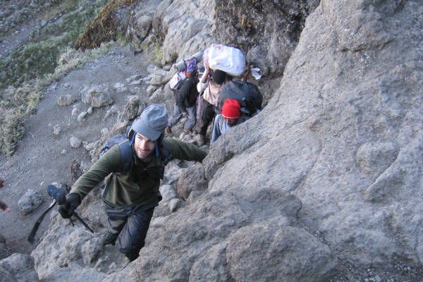
Barranco Wall
On some seven day packages, trekkers will stop here for a brief lunch before continuing on through the barren desert landscape that leads to the Mweka trail and up to Barafu Camp (4,680 meters).
Day 6 – Karanga Camp (3,960m) to Barafu Camp (4,680m)
Distance: 6 km / 4 miles
Trekking time: 3 hours
Zone: High-alpine zone
Day 6 is a relatively short and easy trek. Starting at Karanga Camp, the trail quickly joins the Mweka route and heads up to base camp, Barafu at 4,680m.
We recommend you use the easy day to enjoy the scenery, rest the muscles, and prepare your mind for the summit push.
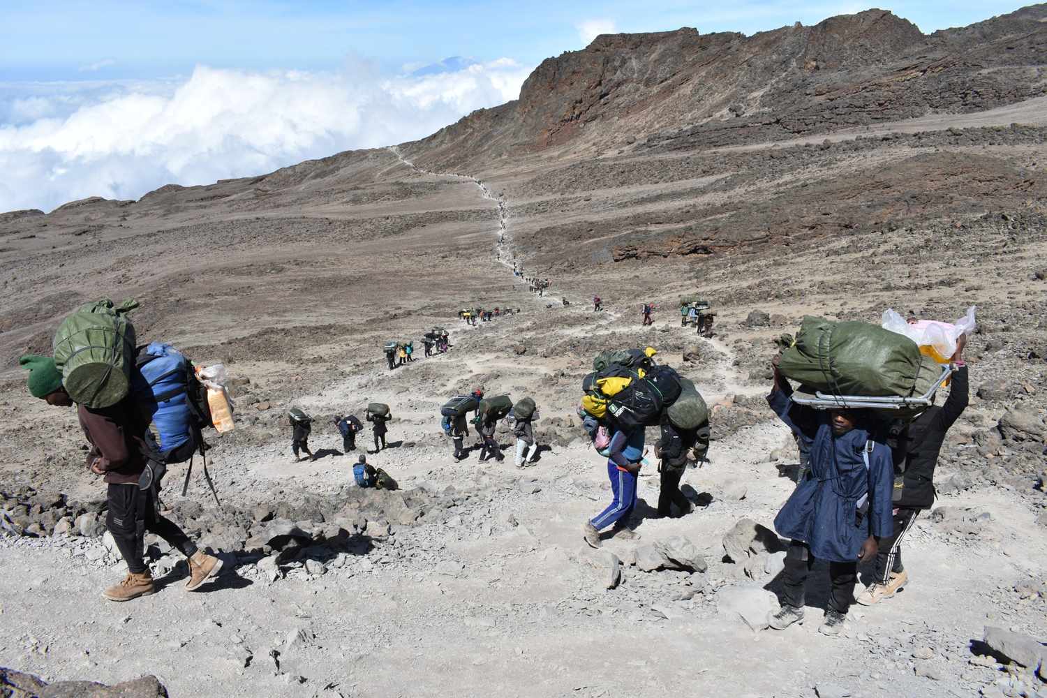
The few km's between Karanga and Barafu are not very scenic. Aso be prepared to get blasted by cold, high altitude winds.
Day 7 – Barafu Camp (4,680 meters) to Uhuru Peak (5,895 meters) and then Mweka Camp (3,100 meters)
Distance: ~4.5km / 3 miles ascent and then 11km / 7 mile descent
Trekking time: 6-8 hours to the summit and then 5-8 hours to Mweka
Zone: Glacial zone and the all preceding zones
Day seven starts at midnight with hot tea, biscuits and a long and zigzagging hike up the heavy scree that covers the steep slopes of Kibo.
The going is slow and very tough. You will need to dig deep and ensure you maintain a consistent pace to push yourself up to the crater rim.
After about 4-6 hours hiking you will reach Stella Point (5,739 meters) where you will have a chance to rest and watch dawn break across the Tanzanian landscape.
It is a good idea to have some hot tea or hot chocolate at this point as you will need to muster the energy to continue for another 1-2 hours around and up the crater rim to Uhuru Peak (5,895 meters).
My Pro Tip: Remember to keep your momentum moving forward, one step at a time. Over 60% of climbers stop at Stella Point but most can make it to the summit if they are able to find the metal strength to push through.
Obviously if you are experiencing severe AMS symptoms you should descend immediately.
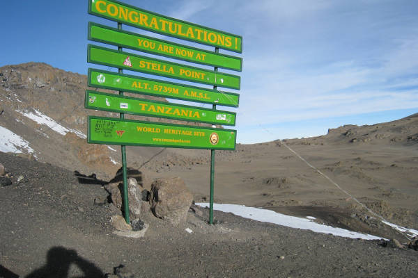
Stella Point
Your time at Uhuru Peak will be brief. Take as many pictures as you can, savour your accomplishment and then start heading back to Stella Point.
Many trekkers slide down the scree slopes of Kibo to Barafu Camp, where you will have a chance to rest before continuing on to Mweka Camp (3,100 meters).
In total you will be trekking between 12-16 hours on day 5 so it is really important that you pace yourself and remain hydrated.
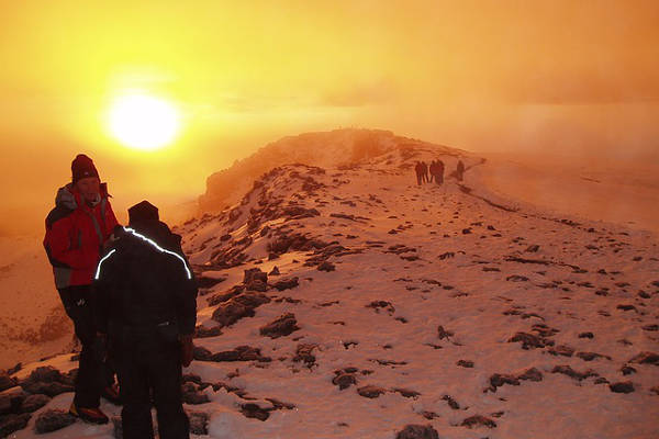
Sunrise, with the summit in the distance. Not far to go now!
Day 8 – Mweka Camp (3,100 meters) to Mweka Gate (1,640 meters)
Distance: ~9km / 5.5 miles
Trekking time: 3-5 hours
Zone: Rainforest
The final day on the mountain is a short one, but nonetheless tiring as your body will be exhausted and your knees will likely be sore from the previous day’s descent.
Go slowly and enjoy the wonderful rainforest scenery as you head towards Mweka Gate (1,640 meters).
At the gate you will need to sign-out with the authorities and will also receive your certificate, either for Stella Point or for Uhuru Peak.
It is customary to pay your tips to your trekking team before you depart back to your hotel in Moshi or Arusha.
7-Day Vs. 8-Day Lemosho Route - What's The Difference?
There are several variations of trekking the Kilimanajro Lemosho Route. Usually, you have an option on how many day's you take to do the route.
Most operators offer a 7 or 8 day option, you might even come across a 6 day Lemosho (not recommended).
Version 1: Skip Shira 1 Camp
For the 7-Day Lemosho Route, some operators skip Shira Camp 1 and continue on to spend the night at Shira Camp 2. This means you would not stay at Moir Hut and also have a very long day of hiking on Day 2.
The distance between Big Tree Camp to Shira 2 is around 15 km / 9.3 miles and takes about 9-10 Hours. Usually, groups stop at Shira 1 for lunch.
Version 2: Skip Karanga Camp
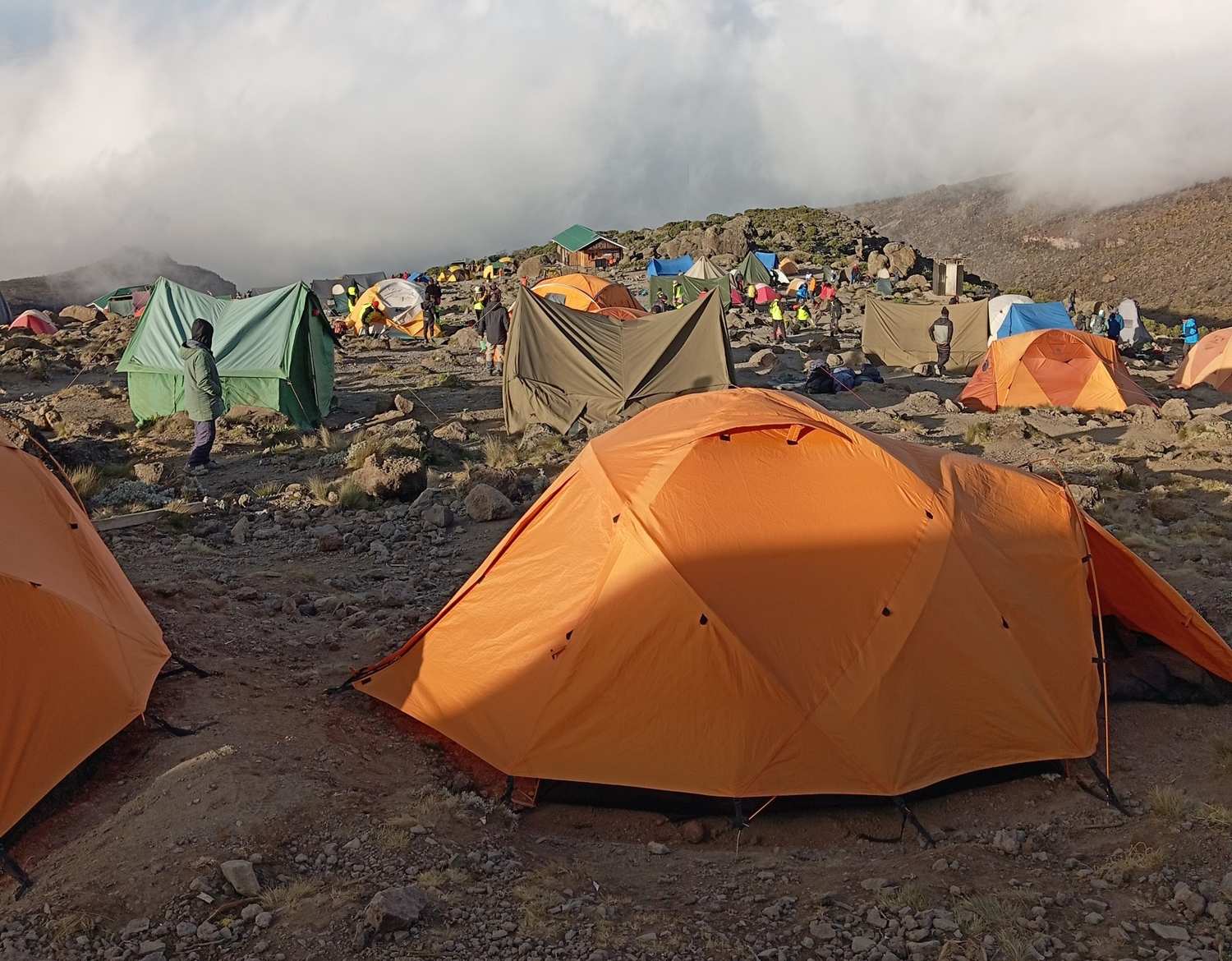
Karanga Camp sits at 3995m above sea level. The extra night at this altitude is important for acclimatization.
Alternatively, some operators running the 7-Day Lemosho route choose to skip Karanga Camp instead. In this case, you would walk directly from Barranco camp to the base camp at Barafu.
This is about 8.5km/ 5.3 miles in total, so not too bad distance wise.
The problem with doing it this way is that trekkers miss out on an extra night at a high altitude camp. This extra can make a big difference in acclimatisation.
My Pro Tip: Generally, I always recommend you choose the 8-Day Lemosho Route. It's better to give yourself an extra day.

Plan your Kilimanjaro trek
Get a quote from my recommended local Kilimanjaro operator
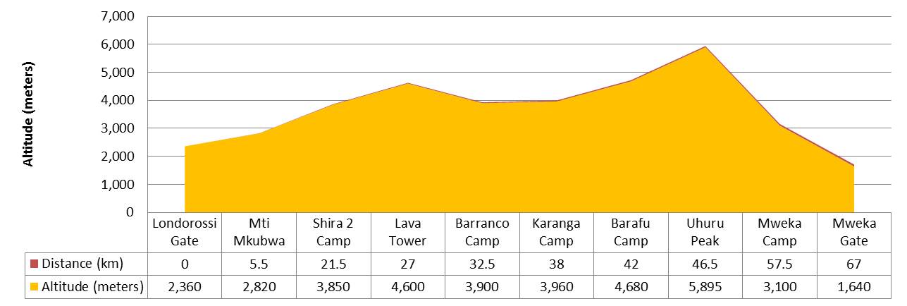
Kilimanjaro Lemosho Route Altitude Profile
Here's what the Kilimanjaro Lemosho route altitude profile looks like.
My Final Thoughts
And there you have it: My personal guide on the Lemosho Route. Did I miss anmything important? Let me know in the comments below and let's share the love.
My other Kilimanjaro routes and helpful guides:

we would like to summit on the Jan 13th full moon. Interested in Lemosho route for 8 days. Recommendations?
I recommend booking with the local guiding team on Skyhook: https://www.skyhookadventure.com/go/climb-kilimanjaro
Hi Mark,
I'm thinking about doing either the Umbwe or Lemosho routes in October. I had heard that the Umbwe route was better for acclimatisation – any views? I have high blood pressure, currently controlled, and wondered whether it could be negatively affected by high altitude – would it prevent me from going on to reach the summit?
Hi Brian, the Umbwe is a faster and more direct route, which generally makes it worse for acclimatisation as it doesn’t have a great profile for walking high and sleeping low. The Lemosho or Machame are a better option. In terms of high blood pressure, unfortunately not qualified to answer that. I recommend having a chat with your doctor to get their input. Very best regards, Mark
Hi Mark – I am in my mid 50s and my tour operator is recommending the high altitude drop-off Shira route (7 days). Initially I had wanted to do the Lemosho route 8 days. What would you recommend?
Hi Latika, I recommend the Lemosho route, it’s lower start point (which is still quite high) is far superior to the Shira start.
Hi, I am planning to do the Lemosho Route over 8 days in December. How many days will I need to wear my thermal base layers and how many changes of clothes would you recommend? I wondering really what temperatures to expect on what days? I appreciate the weather can be changeable the higher you get… any advice would be appreciated.
Hi Mark, one base layer (top and bottom is fine). You will probably start wearing this on day 3 or 4. For detailed information on clothing for Kilimanjaro see here: https://www.climbkilimanjaroguide.com/kilimanjaro-kit-list/kilimanjaro-clothing/ and for weather and what to expect see here: https://www.climbkilimanjaroguide.com/kilimanjaro-weather/
What tour companies do you recommend for the lemosho route?
Hi Evans, complete this form for a quote from my recommended partners: https://www.climbkilimanjaroguide.com/go/
I will be making 3 separate trips in the next few months – June 2019 to January 2020.
I am 62 years old, and will be 63 in November
USA ; 23 June – 02 July
Return to Oman
TANZANIA (Kilimanjaro) : 06 July – 19 July
(Return to Oman)
SRI LANKA : 24 December 2019 – 15 January 2010
(Return to Oman)
Is it better to take a one-year around the world insurance?
Looking forward to your advice and quotation.
Tung Chi
Hi Tung, we are not insurance experts, but I recommend reading this article if you are looking for Kilimanjaro insurance, in particular. https://www.climbkilimanjaroguide.com/kilimanjaro-travel-insurance/
Hello,
Which trek would you recommend Lemosho or Machame beginning of Jul? I have done lot of trekking in the past. I would prefer nice scenery , not so overcrowded.
Thanks in advance,
Lani
Hi Lani, I would go for the Lemosho, it has a quieter start and great acclimatisation profile. It joins up with the Machame on day 3/4 depending on your trek duration. Cheers!
Hi, I am planning to trek Kilimanjaro in late Jan, early Feb 2020. Could I do it by myself (without guide or porter). Is there any guesthouse on the way of trekking for Lemosho or Lachame route? I have some experience with trekking in Nepal and some other places.
Hi Tri, Unfortunately it is not possible to climb Kilimanjaro without a guide. All routes on Kilimanjaro involve camping in tents, except the Marangu, which offers hut accommodation.
Hi I’m interested in lemosho route to climb with my dad
However my dad has had both knee and hip replacements will be climbing the wall an issue for someone who has had all 4 joints replaced
Hi Miriam, scaling Barranco Wall involves a little scrambling. If you dad is comfortable scrambling he should be fine. I know people who have scaled the Wall with prosthetic limbs.
Would you recommend the 7 day Machame route over the 8 day Lemosho route during the first week of November because of the possibility of precipitation or would that not be a consideration in the decision?
Thanks,
Kim
Hi Kim, this shouldn’t be a big concern as you are less likely to experience rain higher up the mountain. I like both routes, but if I was pushed to choose one I would go for the 7 day Machame – it’s shorter and therefore more affordable.
What airport do you recommend flying into and what town to stay in when arriving to do this hike?
Hi Nadia, you need to fly into Kilimanjaro International Airport, here some information on getting there: https://www.climbkilimanjaroguide.com/cheap-flights-to-kilimanjaro/. The two towns you can stay at are Arusha and Moshi. I prefer the latter. Hope this helps!
How important is it to do 8 days instead of 7? What is your personal recommendation?
Hi Nicolas, in terms of the Lemosho route, the 8-day is superior to the 7-day as it gives you more time to acclimitise and the summit push is a shorter day than on the 7-day. If you can only spare 7-days then I recommend you do the Machame.
Hi,
First off your site is so incredibly helpful, thank you!! I am planning to climb the Lemosho Route in mid July and am having trouble finding details of the actual trek at certain points. I.e.: what are the most difficult areas and what makes them so? I know that at no point you need to be roped in, but are there any points that have steep drop off’s, etc where someone who might be nervous about that may need to mentally prepare for? Looking forward to hearing back (in as much detail as possible ;-)!
All the best,
Lyndsay
Hi Lyndsay, Thanks for getting in touch. The most challenging section on the Lemosho route is the Barranco Wall: https://www.climbkilimanjaroguide.com/barranco-wall-mt-kilimanjaro/. But as you will read it is a section that doesn’t require any technical skills. It is merely a short scramble with some minor exposure, no steep drop-offs. In addition to this section the summit push is obviously a tough grind due to the altitude. Hope you have a blast, good luck!
Can you provide any climatic advice on trekking in Sept? I suffered heat stroke on the Kokoda Track and so want to continue trekking but in cooler climatic conditions. I see based on forecasts that the average temp is less than 20 C, is this right and what do you think the averages would be for each of the changes in climate?
thanks Stewart
Hi Stewart, As you would have seen the weather fluctuates a lot of Kilimanjaro as you ascend in altitude. Day 1 in the rain forest is usually quite hot and humid, although there are many places of shade due to the high density of tree cover. Day 2 will probably be your highest risk day for heat stroke as you are out of the tree line and if there is no cloud cover it can get really hot during the day. Temperatures plummet though as the sun goes down or if there is a lot of cloud cover. Day 3 you will be above the clouds, sun UV intensity is high but generally it is not too hot. I would say your risk of heat stroke is lower on Kilimanjaro compared to the Kokoda Trail due to the fluctuation in altitude, but would recommend doing all you can to avoid heat stroke – wear a sun hat at all times, drink loads of fluids and try rest in shady spots as much as possible. Hope this helps!
Hello, great website and really helpful. I’m thinking about doing the Lemosho route (have already requested a quote), is there an optimum time to do the trek? Assuming anytime in September or October before the rainy season?
Thanks
Ben
Hi Ben, Sept and Oct are great months for trekking. Avoid April and May. November is a light rainy season. Dec-March is good for trekking but their is generally more snow at the summit during this time. June-August are the busiest months. Hope this helps!
Hello,
WE would like to trek Lemosho in July with a summit near the full moon.
What was the price? We have spoken to you, Justine Byers and Laurie Jones
Hi Justine, thanks for getting in touch. We are not a tour operator but can connect you with our recommended partner. Just complete the form here and we will put you in touch with them: https://www.climbkilimanjaroguide.com/go/